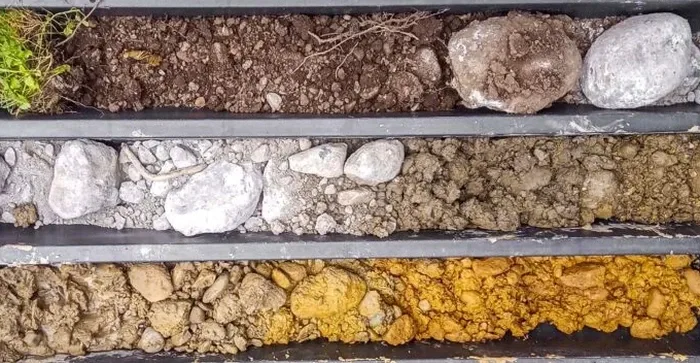
The steel bucket of the excavator cuts through the topsoil off Eight Mile Road, and within minutes our field geologist is climbing into a clean three-foot-wide trench to log the strata. In Stockton, where the subsurface shifts between natural levee sands and pockets of highly compressible organic clay from the San Joaquin River floodplain, an exploratory test pit provides the most direct window into what lies beneath the foundation footprint. Unlike borehole methods that recover disturbed cuttings, this technique exposes the intact profile so we can photograph bedding contacts, measure moisture fronts, and extract block samples that preserve the soil fabric. For projects across San Joaquin County, from industrial warehouses near the airport to residential subdivisions east of Highway 99, the test pit remains the fastest tool for mapping shallow variability when the water table allows excavation depths of 10 to 15 feet.
A single afternoon with an open trench reveals more about the depositional history of Stockton's flood basin than a dozen SPT borings can infer from split-spoon samples.