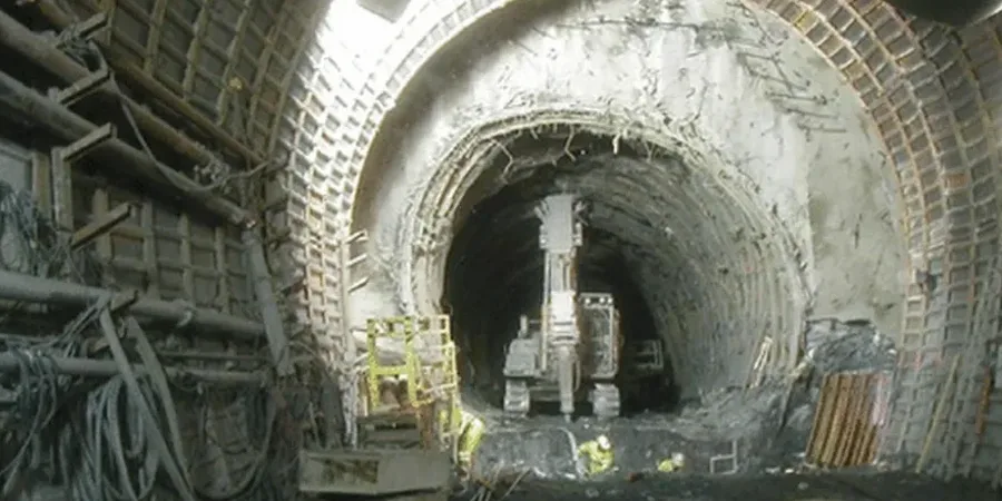
Drive from the newer subdivisions north of Eight Mile Road down toward the old waterfront by the Deep Water Ship Channel, and the ground under Stockton tells two completely different stories. Up north you might hit stiff alluvial layers within 20 feet; down south, near the levees, you can sink an excavator bucket through 50 feet of nothing but fat clay and loose sand before finding anything competent. That contrast is exactly what makes soft ground tunneling in this city a project where the geotechnical narrative has to be written before the first ring is ever installed. When we run a geotechnical analysis for soft soil tunnels in Stockton, we are mapping that deltaic subsurface variability with enough resolution to define face pressures, settlement troughs, and groundwater control measures that actually match what the TBM or the sequential excavation crew will encounter. We have done it for sewer interceptors crossing under the Calaveras River alignment, for stormwater storage tunnels south of Highway 4, and for small-diameter utility bores through the organic silts that nobody sees until they open the first pit. Our lab is set up for the full ASTM program: undisturbed sampling, triaxial CU and UU, one-dimensional consolidation, and permeability testing under backpressure, all run on samples we extract ourselves with thin-wall Shelby tubes and piston samplers to minimize disturbance in those sensitive Stockton clays.
In Stockton’s deltaic deposits, the difference between a successful drive and a stuck TBM often comes down to how well you characterized the clay’s undrained shear strength before mobilization.